
Development of a remote sensing tool for in-season mapping of Scottish potato fields to support the Seed Potato Certification Scheme inspection process
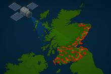
The Scottish seed potato industry has an excellent reputation worldwide as a reliable supplier of high-health seed potatoes to over 40 countries. Central to this reputation is Scotland's rigorous Seed Potato Classification Scheme, which assures the continuing high-health status and purity of Scottish seed potatoes through inspection of all seed potato crops. Ware potato crops grown near seed crops can act as sources of pests and diseases. Growers must notify the Scottish Government of any ware crops which are planted in Scotland. This enables crops to be included in the 10 % of ware crops which are inspected annually. Accurate locations of ware crops underpin the measures which support high potato health in Scotland and ensures a coordinated response in the event of a disease outbreak. As potato cultivation patterns can change dynamically throughout the season, additional tools that support timely identification of potato-growing fields could help target inspections more effectively. This study will investigate whether advanced machine learning techniques can be applied to satellite imagery and historical crop records to develop predictive models capable of identifying potato-growing fields throughout the growing season. This will support timely inspections, the inspection selection process and strengthen disease control and prevention within Scotland’s seed potato sector.